Total site visits
...
Total visits
...
Visitors
Displayed using a lightweight public visitor counter for static sites.
Off-road multimodal dataset
A multimodal perception dataset for autonomous navigation in unstructured outdoor terrain, combining LiDAR, RGB imagery, thermal imaging, radar, INS, and RTK GPS with semantic annotations.
Developed by Texas A&M University and DEVCOM Army Research Laboratory


Visitor analytics
Privacy-friendly counts help the community understand dataset interest without exposing precise individual visitor activity.
Displayed using a lightweight public visitor counter for static sites.
Country or region statistics load only from a configured public aggregate endpoint.
The website does not store analytics data itself and does not include private API keys. Configure only public service identifiers or public aggregate endpoints.
Add a public dashboard URL in _data/analytics.yml after enabling shared analytics.
Research focus
The Great Outdoors Dataset supports robust autonomy research in complex off-road environments where terrain, lighting, vegetation, and surface conditions vary constantly.
Collected with an unmanned ground vehicle designed for unstructured terrain, the dataset brings together high-density 3D point clouds, high-resolution RGB imagery, long-wave infrared imaging, radar, inertial navigation, and precise geolocation. It extends the foundation of RELLIS-3D with additional terrain and object categories for outdoor autonomy.
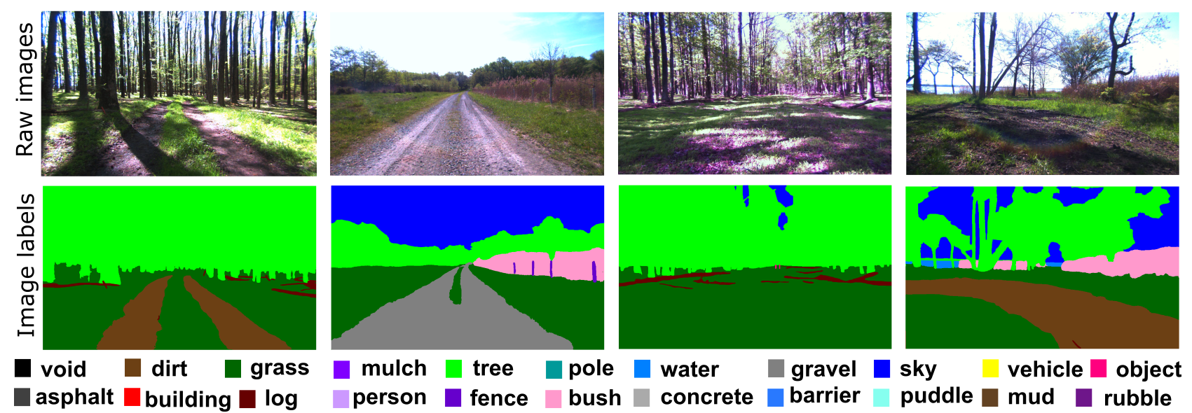
Dataset preview
The data is tailored for machine learning models that need to understand vegetation, trails, mud, rubble, water, barriers, vehicles, and other off-road scene elements.
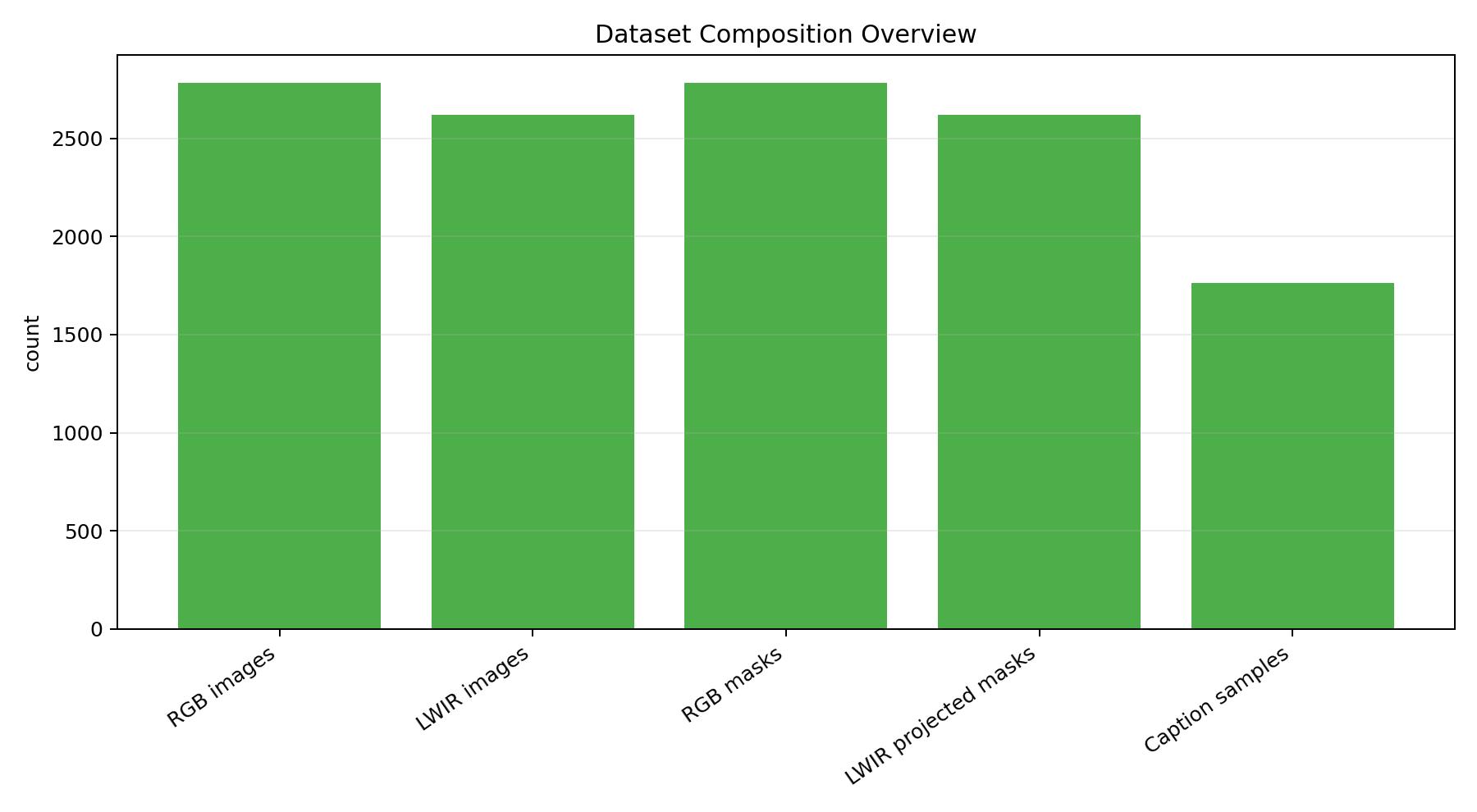
Why it matters
Urban datasets rarely capture the perception problems found in unstructured terrain. This dataset is organized around those harder outdoor conditions.
Combine LiDAR, camera, thermal, radar, INS, and RTK GPS data for multimodal perception pipelines.
Train and evaluate models across terrain, vegetation, people, objects, vehicles, structures, and void regions.
Work with unstructured scenes that include gravel, mulch, mud, puddles, rubble, grass, trees, and water.
Citation
Please cite the Great Outdoors Dataset paper if this data supports your research.
@misc{jiang2025gogreatoutdoorsmultimodal,
  title={GO: The Great Outdoors Multimodal Dataset},
  author={Peng Jiang and Kasi Viswanath and Akhil Nagariya and George Chustz and Maggie Wigness and Philip Osteen and Timothy Overbye and Christian Ellis and Long Quang and Jia Huang and Srikanth Saripalli},
  year={2025},
  eprint={2501.19274},
  archivePrefix={arXiv},
  primaryClass={cs.RO},
  url={https://arxiv.org/abs/2501.19274},
}
Collaborators
Peng Jiang, Kasi Viswanath, Akhil Nagariya, George Chustz, Jia Huang, Srikanth Saripalli
Maggie Wigness, Philip Osteen, Tim Overbye, Christian Ellis, Long Quang
All datasets and code on this page are copyrighted by the authors and published under the Creative Commons Attribution-NonCommercial-ShareAlike 3.0 License.